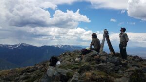
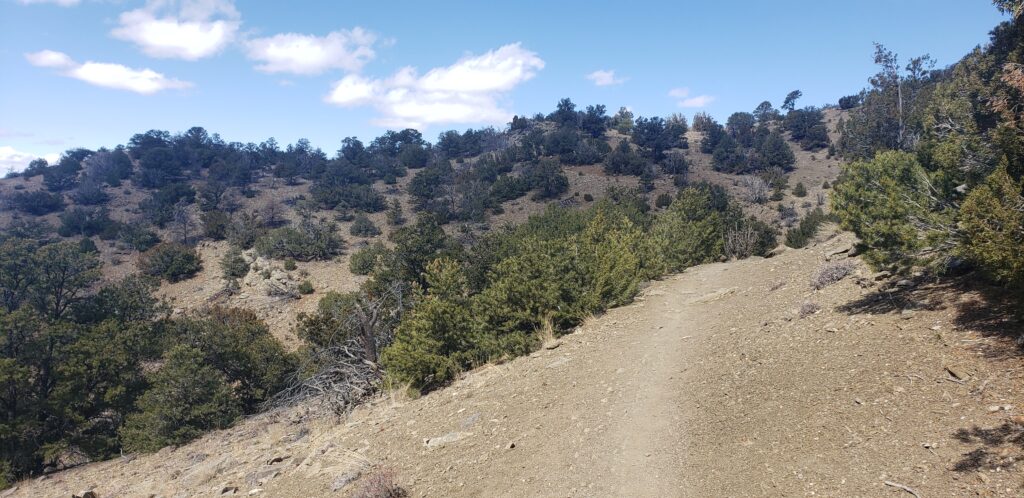
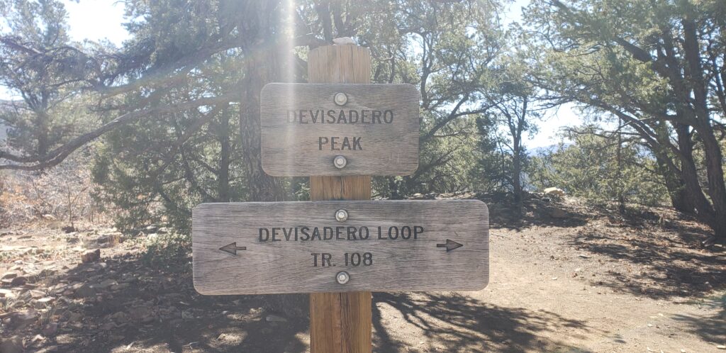
Devisadero Peak, situated just to the east of Taos, is a local favorite for hikers, dog walkers, trail runners, mountain bikers, and folks looking to stretch their legs after a long day cooped up in the office. There are a few options for summiting the peak: as an out-and-back or a loop via the Devisadero Loop trail and as a lengthy endurance event via the North Boundary trail. No matter which adventure you choose, you’ll be rewarded with expansive views of the Town of Taos below and the second largest Rift Valley in the world just beyond.
In addition to holding superb recreational value, Devisadero Peak holds significant cultural value as well. Devisadero is a Spanish word that roughly translates to “lookout” in English, and starting around the 18th century, Devisadero Peak was used as a strategic geographic point. The people of Taos Pueblo would sit atop the peak to watch for incoming Apache, Comanche, Navajo, and Ute who would sometimes travel down Taos Canyon to raid the pueblo.1,6
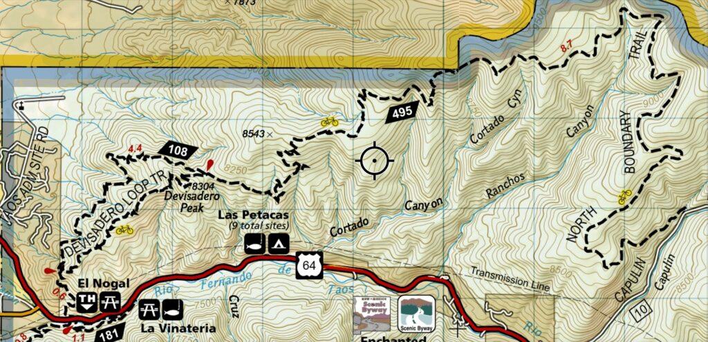
Trail Map:
The trails are open to non-motorized users: hikers, mountain bikers (no e-bikes), and equestrians.
Accessing Devisadero Peak:
- Via the Devisadero Loop trail as an out-and-back:
- Distance: 5 miles roundtrip
- Difficulty: Moderate
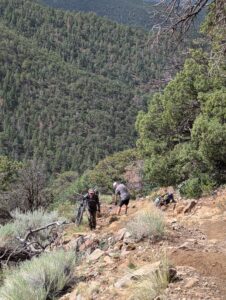
- Description: The trail is rated as moderate due to its steady ascent, uneven and sometimes loose footing, and exposure to the sun and heat. From the trailhead, hike 0.6 miles to a fork in the trail, take the right fork and from there the trail will steadily climb another 1.9 miles before summiting Devisadero Peak. Be sure to stop every now and then during your ascent to glance back at the expansive views of the Town of Taos, the Rio Grande Gorge, and San Antonio Mountain as they unfold below you.
- Via the Devisadero Loop trail:
- Distance: 5.1 miles roundtrip
- Difficulty: Moderate
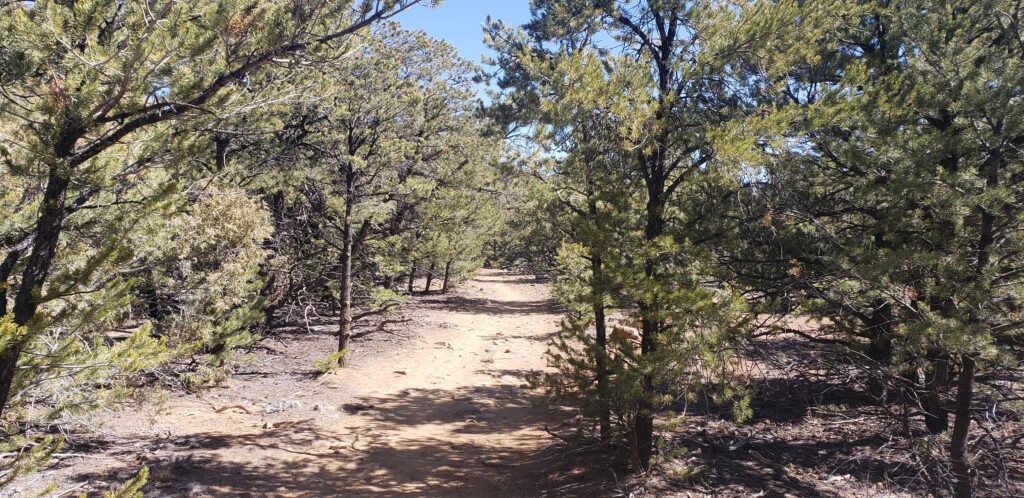
- Description: The trail is rated as moderate due to its steady ascent, uneven and sometimes loose footing, and exposure to the sun and heat. From the trailhead, hike 0.6 miles to a fork in the trail, from here you can take either the right or left fork, both trails climb steadily for about 2 miles up to Devisadero Peak. By taking the loop, you’ll experience two very different forest types characterisitic of northern New Mexico. The south facing trail travels through an arid forest characterized by drought-tolerant trees such as pinyon pine, juniper, and gambel oak. The north facing trail is vastly different; the shade of the mountain creates a darker and cooler environment. On this side of the mountain, you’ll find tall Douglas firs and white firs taking advantage of the reprieve from the sun.
- Via the North Boundary trail:
- Distance: 9 miles one-way
- Difficulty: Difficult
- Description: The trail is rated as difficult due to its steady and steep climbs, uneven and sometimes loose footing, overall length, and exposure to the sun and heat. Accessing Devisadero Peak via the North Boundary trail is a challenging yet rewarding option for those looking for a long day in the saddle or a lengthy day hike. From the North Boundary trailhead on Forest Road 10 (Shadow Mountain Rd), take the North Boundary trail 9 miles west to the summit of Devisadero. The trail follows old two-track for about five miles before narrowing down to rocky, loose, and at times steep singletrack. Once at the peak of Devisadero you have two options: if you thought ahead and shuttled a car, you can continue down either fork of the Devisadero Loop trail to the El Nogal Recreation Area making for a 12ish mile day or you can turn around and head back the way you came to the North Boundary trailhead to up your mileage to 18.
Be Prepared:
The Devisadero Loop trail is exposed for most of its length. The small stature of the trees that comprise the pinyon-juniper forest offer little to no shade in the heat of the day, and there are no water sources along the trail.
Safety Tips:
- Bring plenty of water and electrolytes (more than you think you’ll need)
- Bring plenty of snacks (more than you think you’ll need)
- In the heat of summer, start your adventure early during the cool mornings
- Let someone know where you’re going: leave an itinerary with a trusted friend back home
- Acclimatize yourself before attempting if you’re visiting from a lower elevation: both trails start at 7,200′ and steadily climb up to the 8,304′ peak of Devisadero
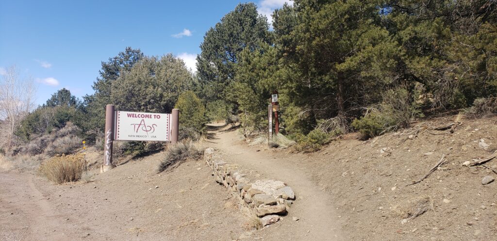
How to Get There and Where to Park:
Devisadero Loop Trailhead:
- Located just east of Taos
- From Taos Plaza, take US Route 64 (aka Paseo del Pueblo) 3 miles east to the outskirts of town.
- Parking: There is a large parking area, the El Nogal Recreation Area (36.375840, -105.546787), to the south of US Route 64. This is the parking area for the Devisadero Loop trail as well as other Forest Service trails to the south.
North Boundary Trailhead:
- Located a little further east of Taos and the Devisadero Loop Trailhead
- From Taos Plaza, take US Route 64 (aka Paseo del Pueblo) 6.7 miles east, take a left turn on to Forest Service Road 10 (Shadow Mountain Rd) and travel north along FSR 10 for 1.3 miles. The trail will be to your left and there will be a large dirt pullout to park in on your right.
- Parking: Large dirt pullout to the right of the trailhead (36.386758, -105.472092)
Additional Resources:
- Carson National Forest – Devisadero Loop Trail 108
- Carson National Forest – North Boundary Trail 495
- FS Map of Devisadero Loop trail: stelprdb5339086.pdf
- Devisadero Peak POI | Trailforks
- Best trails near Devisadero Peak | AllTrails
- Talpa Torreón: A Taos Treasure | Tradiciones / Raices | taosnews.com