The Taos Valley Overlook trails are a local favorite for hikers, bikers, equestrians, and dog walkers alike. Their stacked loop system and varied terrain offer a little something for every type of trail user and ability level.
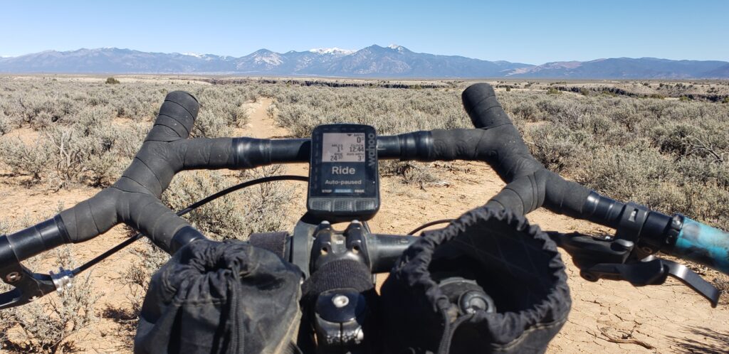
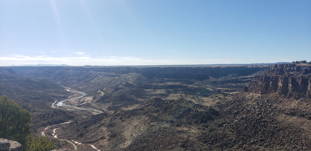
No matter which trail you choose, you’ll be able to take in the expansive views of the snowcapped Sangre de Cristo range, ponder the geologic scale of the ancient volcanic cones looming up from the world’s second largest rift valley, or gaze into the depths of the seemingly endless Rio Grande gorge.
How to Get There and Where to Park:
There are four ways to access the Taos Valley Overlook trails.
- The Slide Trail – Upper Trailhead off of County 110: 36.349194, -105.712619
- Amenities: Pit Toilet, Picnic Tables
- Rift Valley Trailhead off of State Highway 68: 36.323207, -105.703628
- Amenities: None
- The Slide Trail – Lower Trailhead: 36.337723, -105.727205
- Amenities: None
- Picuris Trailhead: 36.335122, -105.733122
- Amenities: Pit Toilet
Trail System:
All trails are open to non-motorized users: hikers, mountain bikers (e-bikes are not allowed), and equestrians.
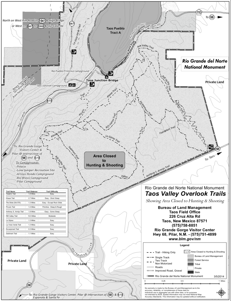
Popular Trails:
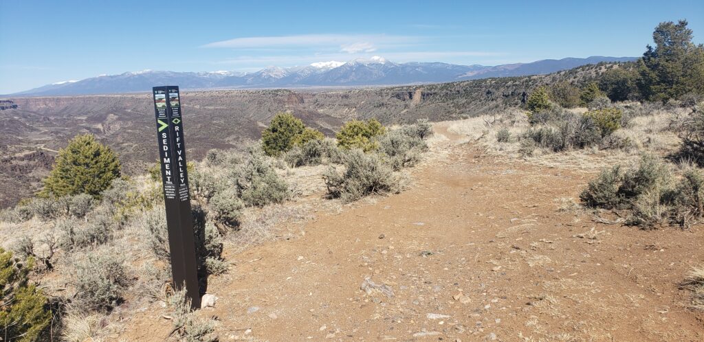
- Rift Valley Loop:
- Distance: 10 miles
- Difficulty: Easy to Moderate
- Description: The Rift Valley Loop makes for an excellent beginner mountain bike trail or a moderate, lengthy day hike. This single-track trail gently undulates down into washes and up over mesas through a forest of pinyon pine, juniper, and sagebrush. There are no technical features, but be prepared for plenty of loose rocks and baby heads.
- Trader’s Trail:
- Distance: 1.7 miles (one way)
- Difficulty: Easy
- Description: If you’re looking for easy access to gaze into the depths of the Rio Grande Gorge, then the Traders Trail is the one for you. The Traders Trail is a short, out-and-back with very little elevation gain or loss. It’s a wide two-track with ample room, long sightlines, and no technical features, making it the perfect trail for folks of any ability level.
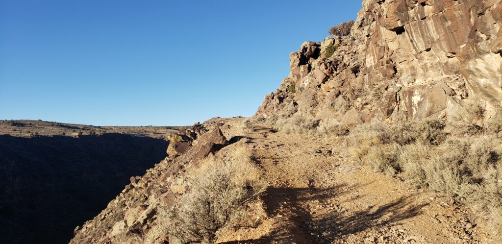
- Slide Trail:
- Distance: 1.3 miles (one way)
- Difficulty: Easy (except for a short section that travels through a rock slide)
- Description: The Slide Trail starts on top of the Rift Valley and quickly descends 500′ into the Rio Grande gorge along the Rio Pueblo de Taos, a tributary of the Rio Grande River. The trail follows an old roadbed that’s wide, flat, and free of technical features. About halfway down, the trail gets a little tricky where it travels through an old rockslide. The trail becomes uneven and narrow; if you’re biking, you’ll need to dismount and maneuver your bike over some fallen rocks.
- Picuris Trail:
- Distance: 1.4 miles (one way)
- Difficulty: Moderate – the trail is primitive, steep, and rough
- Description: The Picuris Trail is a primitive, single-track trail that quickly descends from Rift Valley to the Taos Junction Bridge and Rio Grande River below. Mountain biking is allowed but not recommended on this trail. The Picuris Trail is steep, rocky, narrow, and exposed for most of its length.
The Adventures Are Endless
For the truly adventurous or folks looking for a long day in the saddle, you can connect the Taos Valley Overlook Trails with the Vista Verde, Petaca Point, or West Rim trails by taking the Taos Junction Bridge to the west side of the Rio Grande River.